About This Quiz
The geography of the UK defined much of its history, determining economic hubs, the locations of ports, where manufacturing took place, ancient borders and even when invaders were or were not successful. Its natural beauty extends from the warmer south to the stark beauty of its northernmost islands. The UK contains natural resources from mineral deposits to hydropower to oil fields. Its geography is the reason it was so simple for early paleontologists to find dinosaur fossils. It is how ancient burials were preserved. Britain's geography is the reason its ancient people were able to mine, shape and transport the huge stone slabs that are Stonehenge.
The UK's stately homes are well known, but the natural beauty of the land is often overlooked in favor of the achievements of Britons in shaping the landscape with roads, rails and tunnels. Even ancient people made their marks on the look of the countryside, carving The White Horse of Uffington into the very earth. and the unforgettable if rather rude image of the Cerne Abbas Giant, similarly tattooed into the countryside.
Do you take the land around you for granted or are you as fascinated with its natural wonders as we are? It's time to test your knowledge of British geography!
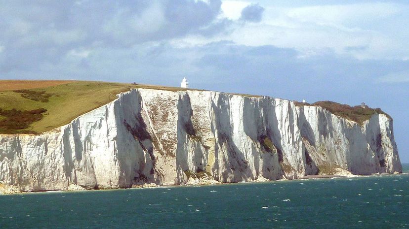
Situated near Dover Castle, The White Cliffs of Dover are one of the most iconic images of Britain, appearing in paintings, photographs and films. They performed an important role in WW2, being topped with radar banks keeping a lookout for German aircraft.
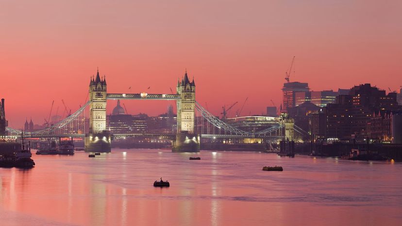
With 45 navigational locks, the Thames remains important to maritime transport. Guarded by the Thames Barrier, a huge, mechanical wall, the Thames is protected from the storm surge of any potential storm in the North Sea that would otherwise flood London.
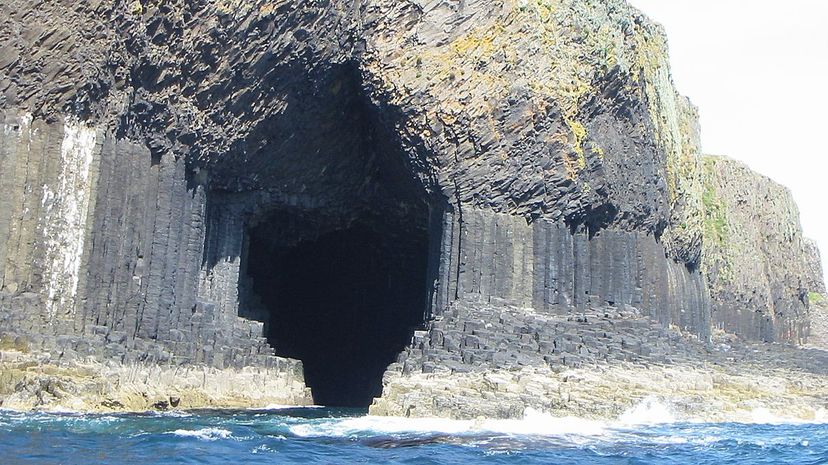
Looking like something out of a David Lynch film, Fingal's Cave sits on an uninhabited island in Scotland. Noted for its acoustics, it owes its unique appearance and shape to its composition: basalt rock.
Advertisement
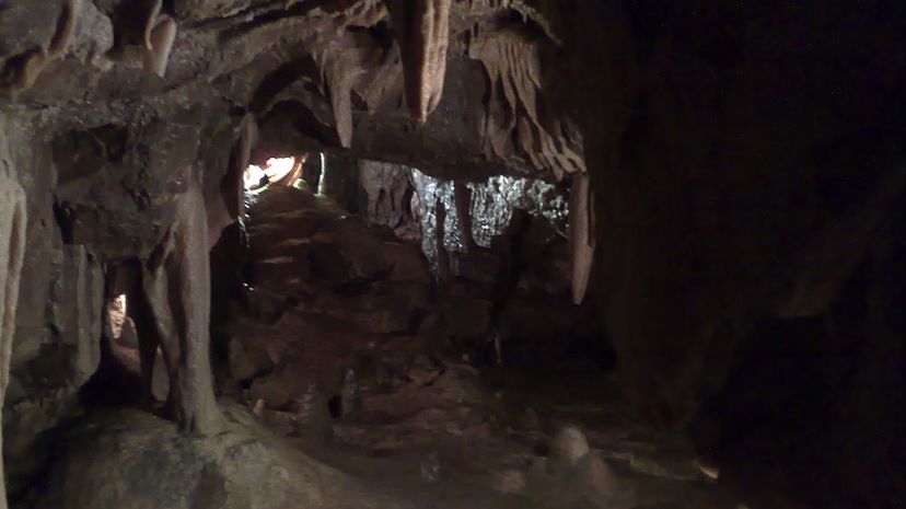
Discovered by lead miners two hundred years ago, Stump Cross Caverns are a natural cave system, not a mine. Over the years, cave explorers have found the remains of ancient animals, and even reindeer! Located in Yorkshire, it's not even very far away.
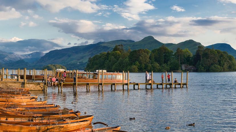
Located in northwest England, The Lake District is a picturesque region of small mountains, deep lakes and spectacular views. Geologically similar to Scotland but populated with different flora, this area is a popular place for holidays for good reason.
The Three Peaks are three mountains that form the basis of The Three Peaks Challenge. These mountains are Scafell Pike, Ben Nevis and Snowdon, the tallest mountains in England, Scotland and Wales, respectively.
Advertisement
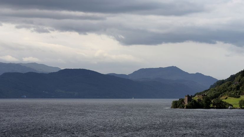
Loch Ness is one of many gorgeous lochs in Scotland, but it is one of the best known lakes in the world because of its most famous resident, the Loch Ness Monster, affectionately known as Nessie. Have you spotted her?
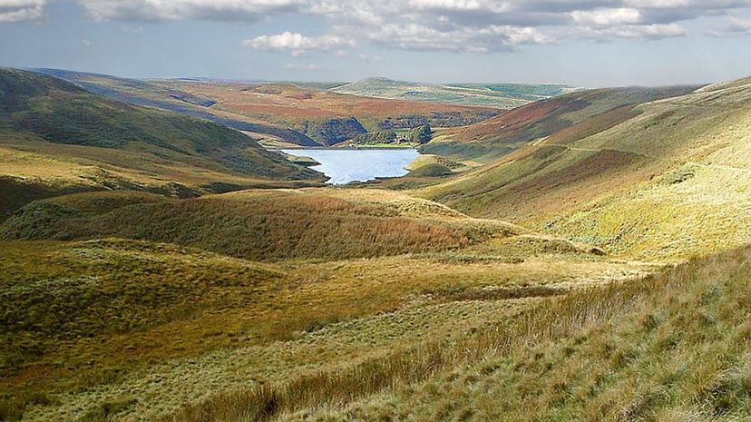
One of the two longest trails in the UK, the creation of The Pennine Way was inspired by the Appalachian Trail in America. The Pennine Way is a difficult trail, but it both passes through some beautiful countryside and is full of friendly ramblers.
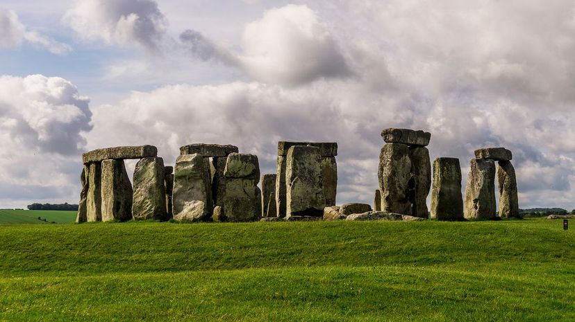
Salisbury Plain is anything but plain. It is bisected by a road that partially runs below the surface of the plain in order to keep the views pristine. The reason for this need is Salisbury Plain contains Stonehenge, the iconic Stone Age site.
Advertisement
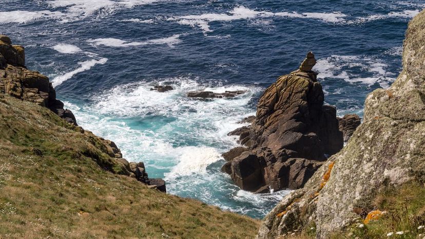
Land's End is the bleak, granite coastal fringe of Cornwall, before reaching into the Atlantic Ocean. It is the most westerly point in England.
Cheddar Gorge, so named because it is near the town of Cheddar, is the home of the original cheddar cheese. At the bottom of the deepest parts of the gorge is a small cave system, in which cheddar cheese is aged, and visitors can be given guided tours.
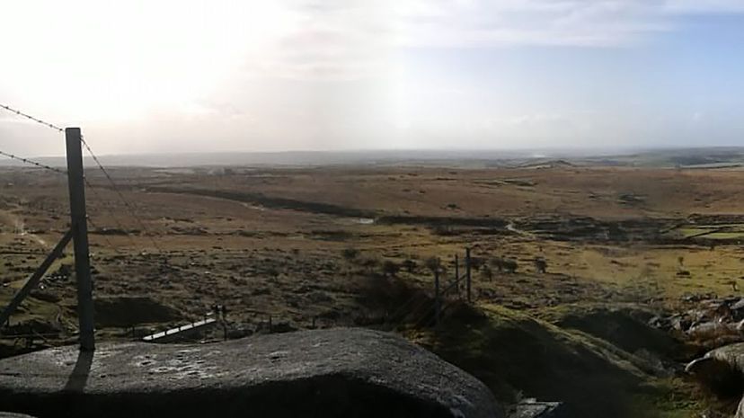
Bodmin Moor is a vast expanse in Cornwall, noted for its granite underpinnings and the highest point in Cornwall, the oddly named Brown Willie. Home to many old legends, the one concerning the Beast of Bodmin has, oddly, only been around since the 1970s.
Advertisement
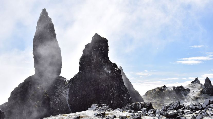
The Old Man of Storr is a rock formation on The Isle of Skye, in the furthest reaches of Scotland. Part of a much larger area of great natural beauty called The Sanctuary, it abuts The Storr, a mountain with a side of rock exposed due to landslip. The Old Man, however, stands alone.
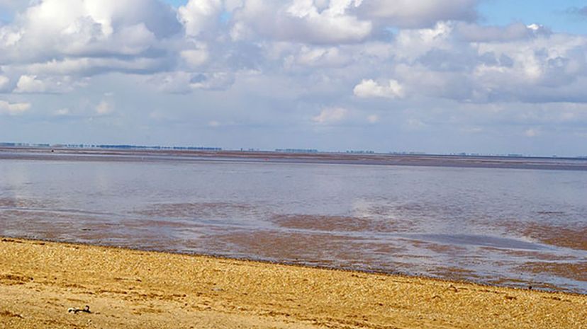
When Lincolnshire and Norfolk meet and four rivers collide, it all comes out in The Wash. A huge estuary, The Wash spills into the North Sea.
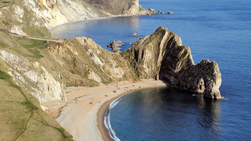
Were it not for Mary Anning and The Jurassic Coast, paleontology would not be what it is today. So called because of the tremendous exposed rock and fossils, The Jurassic Coast frequently gives up its secrets as it erodes, exposing the bones of prehistoric creatures, and giving up the secrets of how the land used to be.
Advertisement
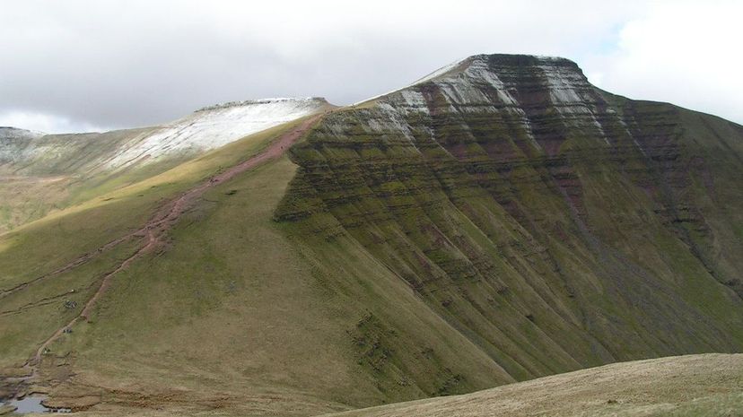
Pen y Fan is the highest peak in South Wales, standing a full 2,907 feet at its highest elevation. Used for military training by the government, soldiers have died while attempting its conquest in their survival and navigation exercises.
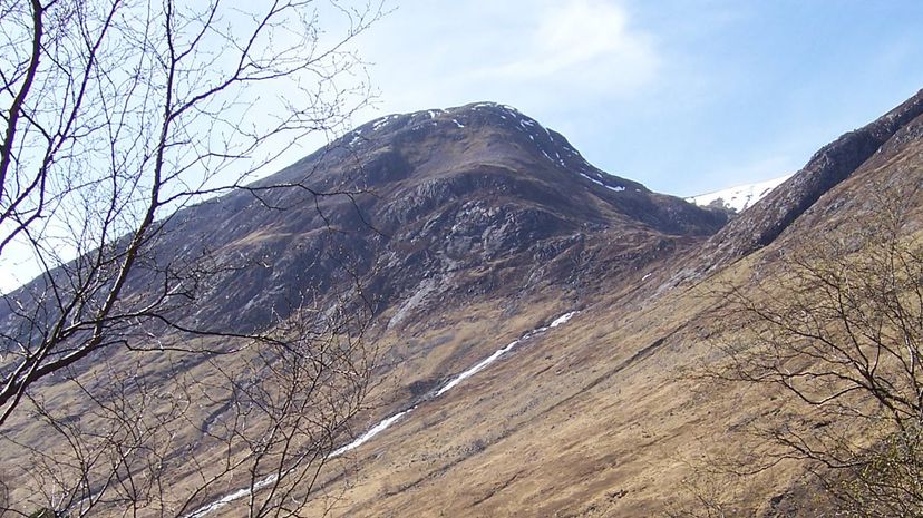
The highest mountain in all of the British Isles, Ben Nevis was once a towering volcano, though those days are long in the past. The name is derived from the Gaelic for mountain, and a word of which no one can remember the meaning.
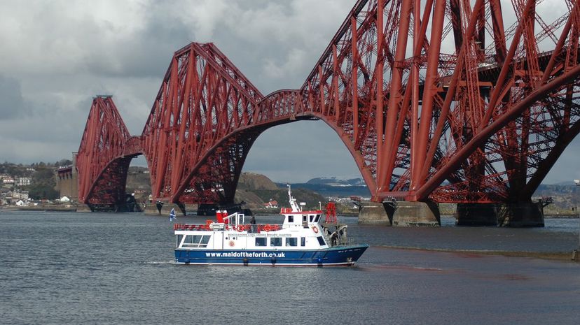
The Firth of Forth is the fjord into which the Forth River empties. This is the body famously crossed by The Forth Bridge, a structure so huge that the time it takes a crew to paint it is equal to the time it takes for the oldest parts of the paint to need repainting.
Advertisement
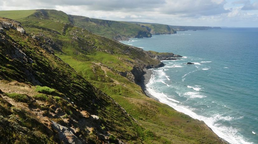
Cornwall's High Cliff is one of the best-named places in the whole world! Rather than attempting poetry, whoever named it was quite literal: The cliff is the highest drop in Cornwall with a height of 732 feet!
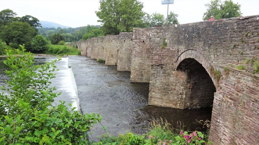
The River Usk flows from the Black Mountain in Wales, east, and then south to the sea. As it goes, it passes the town of Caerleon, the site of a Roman ruin which seems to have inspired many of the details of the myths in the Arthurian Legend.
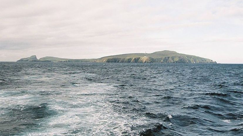
Shetland is a one-of-a-kind place. Surrounded by other islands, its history includes mining and subsistence farming on the unforgiving hillsides. Today, its money comes from the vast oil below it.
Advertisement
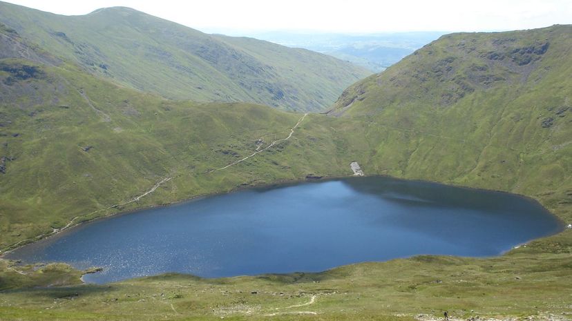
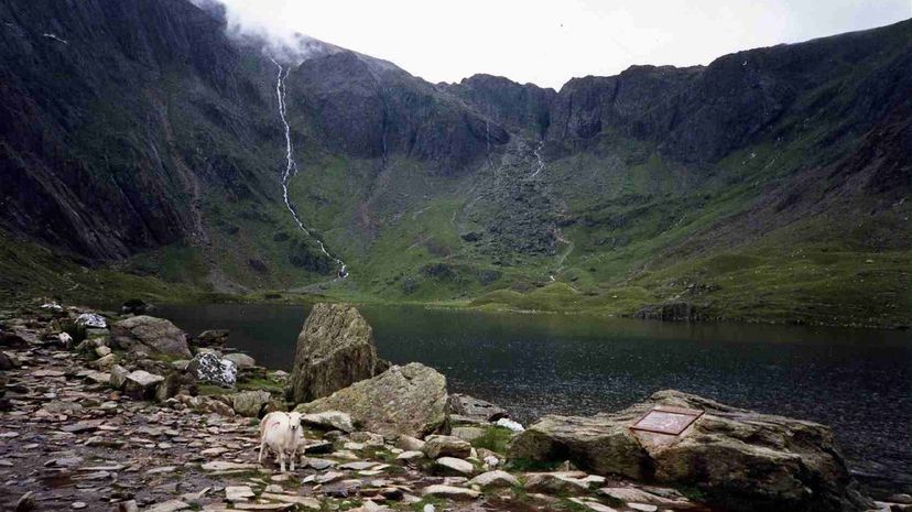
Grisedale Tarn earns its last name from how it was formed. Tarns are lakes created by the act of a glacier carving out a depression in the land, which later forms a lake.
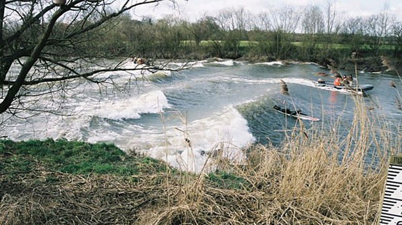
The Severn River is the longest river in the UK, and when it empties into the ocean, something very strange happens. It develops the Severn Bore, a strange phenomenon when the tidal forces of the ocean collide with the river, creating a wave of water that travels upstream!
The Heart of England Forest charity was funded by publisher Felix Dennis, hence the affectionate nickname. A new forest in the truest sense of the word, it is comprised entirely of native British species, ensuring that the landscape remains unique in the world.
Advertisement
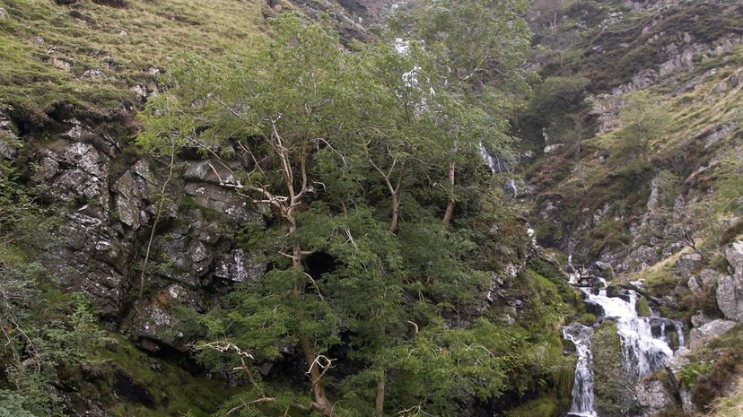
Cautley Spout is the highest above-ground cascade waterfall in England. That reads as a lot of caveats, but it is important to be specific. After all, in England there are other waterfalls that have greater unbroken falls, and there are longer ones.
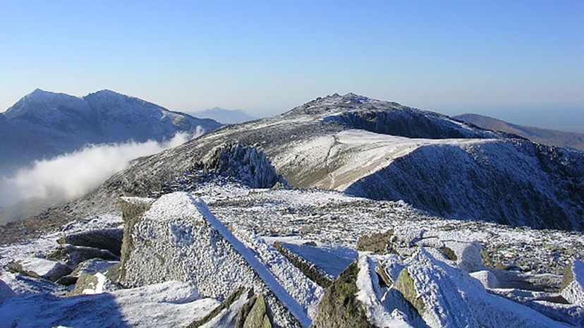
With a peak elevation at 3,284, the craggy Glyder Fawr is the highest mountain peak in the Glyderau Mountains. Created in part by the dissolution of glaciers which deposited rocks all around the area, the mountain's name is derived from the Welsh for "heap of rocks".
The tallest waterfall in Wales, The Devil's Appendix isn't a very powerful waterfall. As a result, it does not flow all year, turning what was a waterfall into a surface for climbers for part of the year.
Advertisement
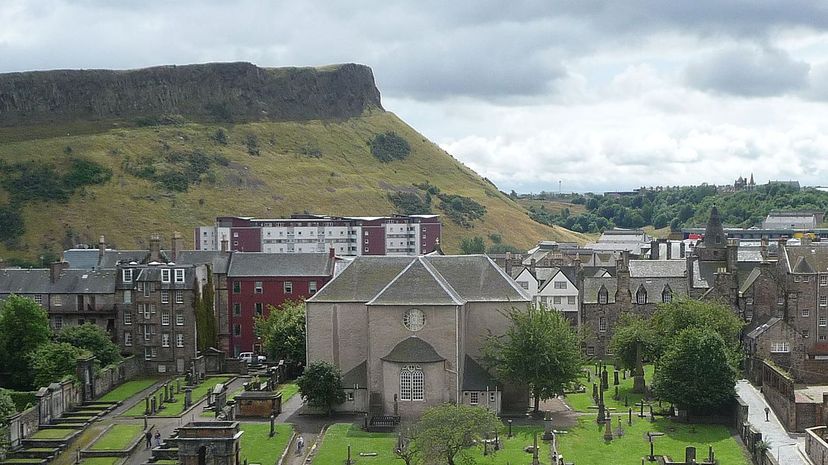
Arthur's Seat has not erupted in an eternity, instead providing Edinburgh with its unique landscape. Topping out at an elevation of 823 feet, it is unclear why it is called "Arthur's Seat," but one theory points to the Arthurian legend.
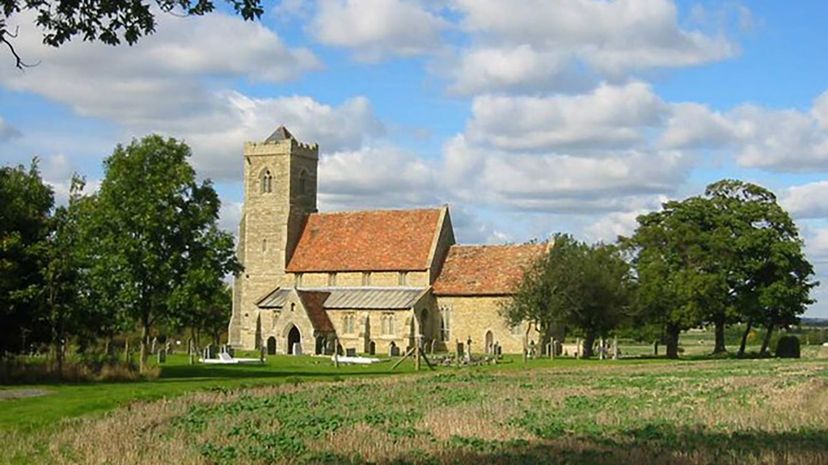
The Fens, also called The Fenlands, is the lowest place in the UK, similar in many ways to parts of Holland. This area has been home to a plethora of churches and monasteries since the Dark Ages.
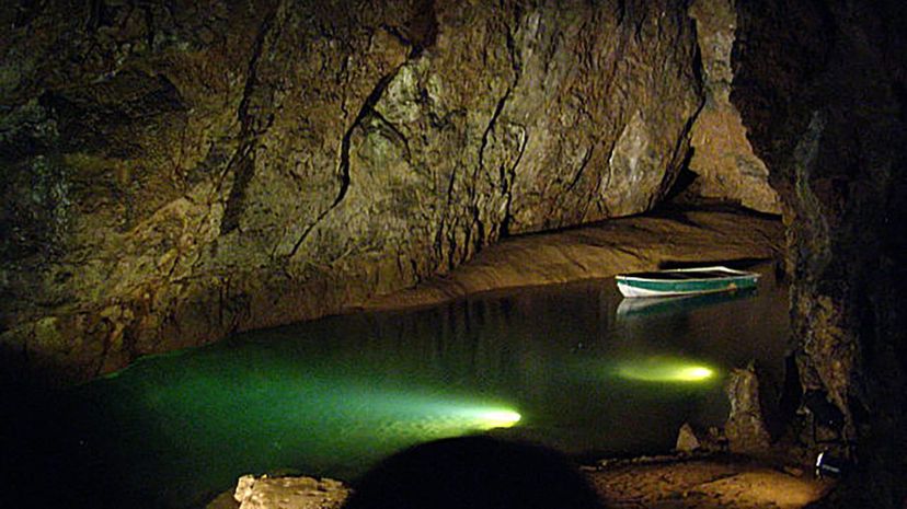
The Wookey Hole Caves aren't just for spelunkers, but for families, as it has turned into a genuine tourist attraction, complete with a crazy golf course and special events for children at Christmas. It is worth noting that the double o in Wookey Hole is pronounced like the double o in snooker, not as in Wookiee.
Advertisement
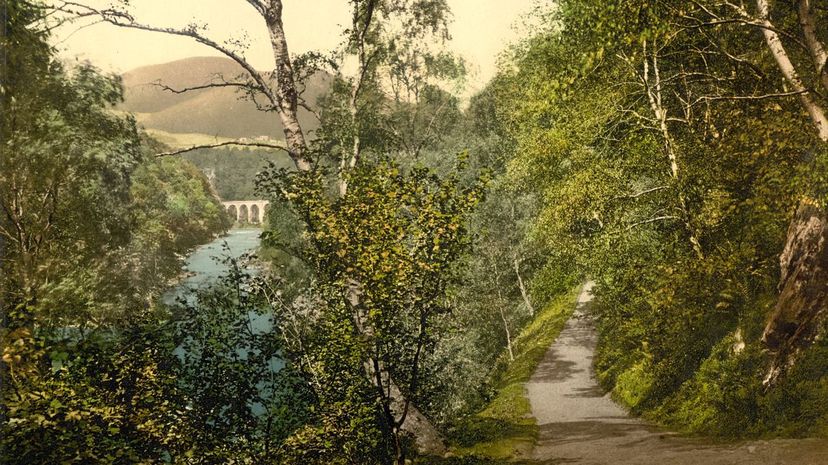
The Pass of Killiecrankie is an important mountain pass in Scotland. It is also near the location of the Battle of Killiecrankie, fought by the Jacobites.
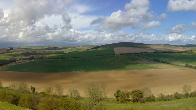
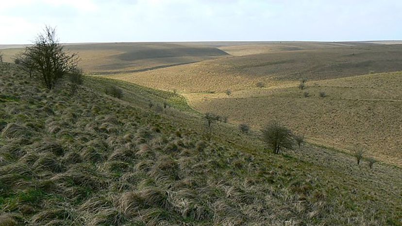
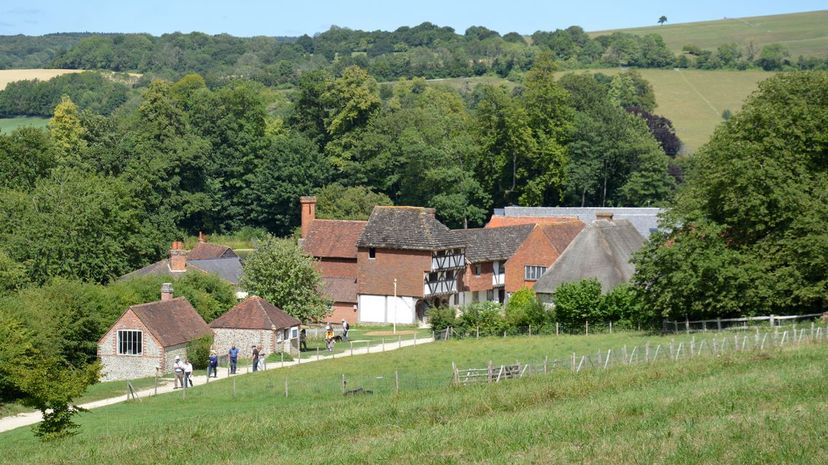
The South Downs include the biggest national park in the UK, which is actually larger than the chalk hills which characterize the South Downs. With a landscape shaped by grazing animals, it's no surprise that the South Downs have their own breed of sheep: Southdown sheep.
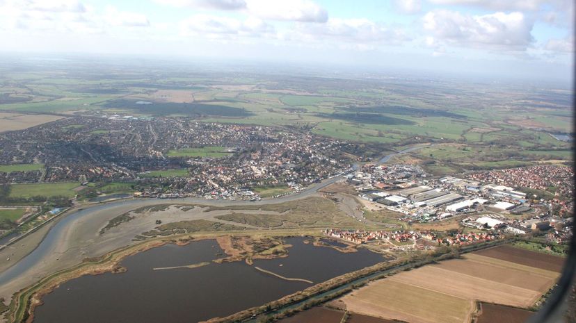
Northey Island is a windswept island in Essex connected to the mainland by a sandbar which disappears at high tide. It was the site of a massive Viking invasion in 991 AD that presaged the conquest of England by Swain Forkbeard of Denmark.
Advertisement
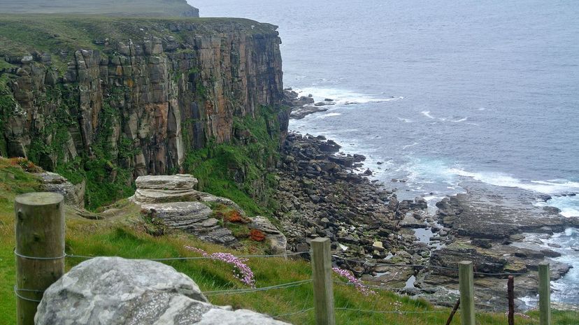
Dunnet Head is the most northerly place in the mainland UK, sitting just to the north of the nearby town of John o' Groats. There are more northerly places in the UK, but they are all outlying islands.
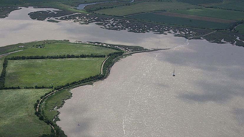
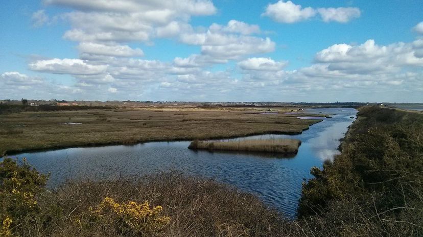
The Blackwater Estuary faces east from Maldon, and not only fosters important local birds and fish, but it's also an important historical site, the Anglo-Saxon structures and fishing gear frequently emerging from land and sea. This is where Maldon salt comes from!
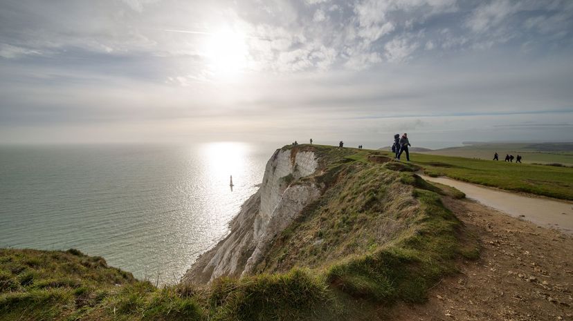
Beachy Head is part of the many chalky cliffs along the southeast coast of England. Resembling the wall of a fortress, much of what keeps Britain safe from invasion resides in the geology of its surroundings.
Advertisement
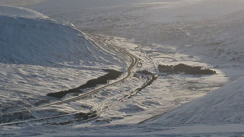
Drumochter Pass is where the southern and northern highlands meet, where the water looks like it doesn't know where to go because it can flow in either direction. Were this pass to snow in, the highlands would become far less accessible.
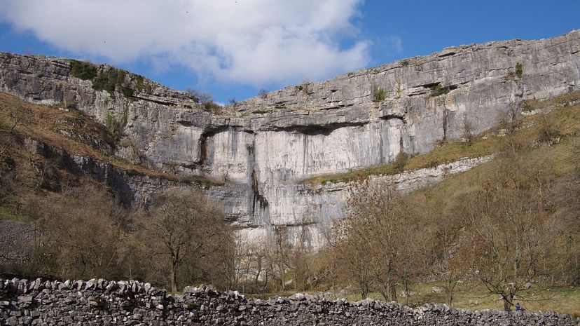
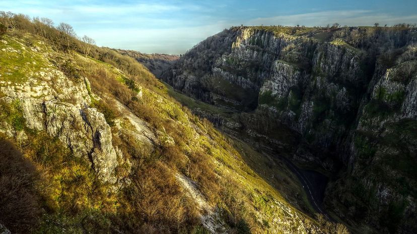
Malham Cove was once a waterfall, many thousands of years ago. The waterfall drained a prehistoric glacier, now long gone. Atop Malham Cove is what is called its limestone pavement, a location perhaps most recognized from its appearance in a "Harry Potter" film.
Like many "new" things in the UK, The New Forest is not new, being named a royal forest by William the Conqueror. It remains one of the only unenclosed forests in England.
Advertisement
The Weald, meaning "The Woodland" in Old English, holds an important place in British history. Specifically, it is the place where Henry VIII's regime began production of iron cannon, which, being far cheaper than bronze cannon, could be mounted shipboard, forming the teeth of the British Navy.