About This Quiz
Put your geography knowledge to the test with this quiz!
Geography is one of the Social Studies, and High School Geography branches away from the United States and explores the Earth's water, landforms, climates and systems. In elementary and middle school, you may remember studying maps of the U.S., and your classroom probably had a globe. In high school, you learned about the connection between history and geography, both man-made and natural (human vs. physical geography). After all, not only has the world changed as it aged, but alao people changed the world's borders.
To call yourself an expert in geography, you'll need to know how to use the tools of geography, including maps and charts; you'll need to know how humans have influenced global culture and economics (human geography); and you'll need to know intricate information about the regions of the world, including North America, South America, Europe, Asia, Africa and Australia. For you to know all of this, you must have an IQ of more than 130! But don't let us scare you away - try it for yourself and then challenge your friends.
So, get ready to test your geography IQ and explore the world with this fact-filled High School Geography quiz.
The Bering Strait separates North America from Asia. Specifically, the Bering Strait separates the U.S. from Russia.
The Gulf of Mexico is the largest gulf in the world. A gulf is a basin of the sea that creeps over the land.
Denali is the highest point in North America. Named Mt. McKinley outside of Alaska for many years, a naming dispute between the Alaskan state legislature and the federal government restored the name "Denali", which was what it had been called by Alaskan indigenous peoples.
Advertisement
The Great Plains is the world's largest prairie. The Great Plains covers all of Kansas, Nebraska, South Dakota and North Dakota, along with parts of other states.
Water covers more than 70% of the Earth's surface. The world's oceans are largely unexplored.
Canada is not a continent. Canada is located on the continent of North America.
Advertisement
The Pacific Ocean is the largest, deepest ocean in the world. The Arctic Ocean is the smallest.
The imaginary line that separates the Northern and Southern Hemispheres is called the equator. The equator is halfway between the North and South Poles.
An extension of land surrounded by water on three sides is called a peninsula. Florida is a peninsula.
Advertisement
Weather patterns that exist within a particular region are referred to as climate. Climate relies on long-term observations.
Asia is the most populated continent. Antarctica is the least populated.
A globe is a scale model of the Earth. Globes show land, water, distance and direction.
Advertisement
You will not find chemical symbols on a map. Look for those on a periodic chart in your chemistry class.
The Rocky Mountains are called the backbone of North America. Also called The Rockies, they run from Canada to New Mexico.
The Rio Grande runs along part of the U.S.-Mexican border. The name is Spanish for "Big River."
Advertisement
There is no Great Lake named Washington. The Great Lakes are Huron, Ontario, Michigan, Erie and Superior.
North America's largest canyon is the Grand Canyon. The Grand Canyon is located in Arizona.
Mt. Logan is Canada's highest point. The mountain was named after Canadian geologist, Sir William Edmond Logan.
Advertisement
Antarctica is the least populated continent. Asia is the most populated.
There is no such thing as the Red Ocean. There is, however, a Red Sea.
Russia is the largest country by landmass in the world. Russia is over 6 million square miles.
Advertisement
Mt. Everest is the highest point on earth. Everest stands a whopping 29,029 feet.
Lake Superior is the world's largest freshwater lake. Lake Superior is one of the Great Lakes.
The Indian Ocean is the warmest ocean. The Arctic ocean is the coldest.
Advertisement
The Dead Sea is the lowest point on land. The Dead Sea sits over 1,300 feet below sea level.
The Middle East is called the "Crossroads of the Ancient World." The Middle East controls much of the world's oil supply.
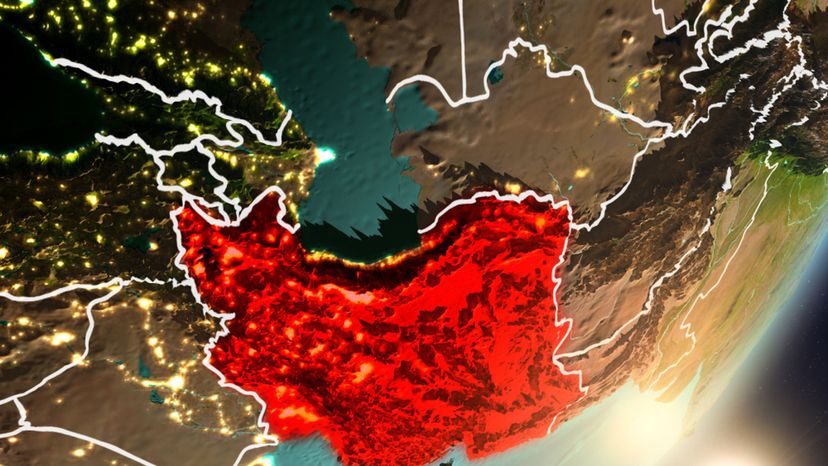
Before World War I, Iran was known as Persia. The name was changed in 1935.
Advertisement
Damascus is the capital of Syria. The city was settled over four thousand years ago.
The Suez Canal separates Africa and Asia. The Suez Canal is in Egypt.
A chain or cluster of islands is called an archipelago. The Bahamas are a well-known archipelago.
Advertisement
A map is a flat representation of the Earth, or a portion of it. Maps, because they are flat, are actually distorted representations.
Mt. Ararat is in Turkey. It is the highest point in Turkey.
China is the world's most populous country. China is home to over 1.4 billion people.
Advertisement
Imaginary lines that run parallel to the equator are called latitude. The Equator has a latitude of 0°.