About This Quiz
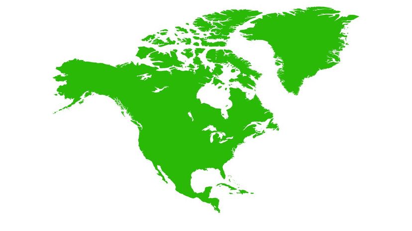
Wasn't it Lee Greenwood who sang, "From the lakes of Minnesota, to the hills of Tennessee?" Think of this as the quiz version of that iconic and patriotic song. But, let's kick it up a notch. Because this isn't just a stroll "from the mountains, to the prairies, to the oceans white with foam" in the United States, but a mental walk through "O, Canada's" "home and native land" and Mexico's "fatherland." It's an all-inclusive, all-expenses-paid journey through some of the most interesting geographical regions of North America.
Have you ever seen the world's smallest river? How about visited a triple landlocked state? Maybe you're more interested in the island life – North America has the largest lake island in the world, really! Or, perhaps you're more the "mountain" type. North America also boasts the world's largest's vertical drop and the world's tallest mountain. To borrow a phrase from the United States, North America is a veritable melting pot of geographic features from the highest "highs" to the lowest (below sea level) "lows."
Test your North American geography knowledge in this quiz by matching our carefully curated clues to the right range, river or region. We think you'll agree geography is where it's at! (Get it?!) Let's go!
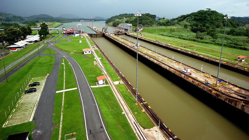
The Isthmus of Panama simultaneously connects North and South America and divides the Pacific Ocean and the Caribbean Sea. Experts believe the isthmus was created thanks to volcanic activity and the build-up of sediment. Shown here is the Panama Canal.
It's no surprise that Alaska is the U.S.'s northernmost and westernmost points, but the easternmost designation might throw some people for a loop. As it turns out, Alaska's Aleutian Islands reach far enough east to make it the easternmost point as well, as they cross into the Eastern Hemisphere.
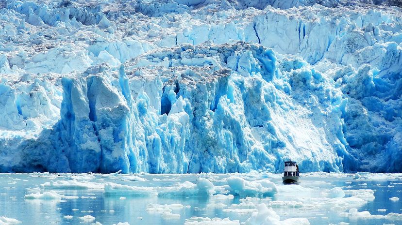
Greenland earns the world's title of "largest island" over Australia because Australia is considered a continent. Greenland makes up roughly 836,000 square miles but only has about 56,000 people so there's plenty of room to spread out.
Advertisement
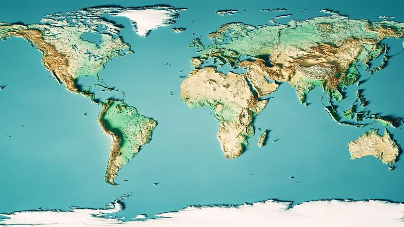
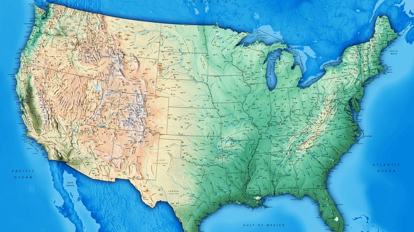
North America is third in continent size behind Asia and Africa. It is made up of roughly 9.5 million square miles. While that sounds large, all of North America could fit neatly inside of Africa with room to spare!
Canada is a sizable country, so it's no surprise that it's home to an abundance of water. It is, in fact, host to the largest percentage – up to 60%! – of all of the world's natural lakes.
The Rocky Mountains, which are made up of more than 100 separate mountain ranges, also make up the area known as the Great Divide. This is where the water that runs to the Pacific and the Atlantic separates.
Advertisement
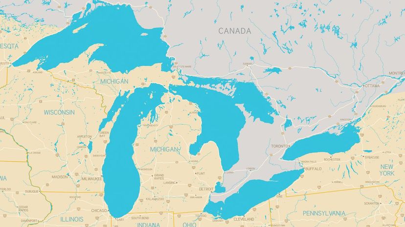
Superior indeed! Lake Superior's 31,000 square miles touch Michigan, Wisconsin, Minnesota and Canada. If you were to drain it, it could fit all of the water from the four remaining Great Lakes combined.
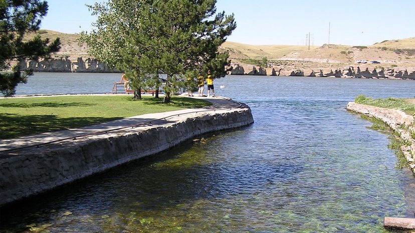
Montana's Roe River wouldn't be great for floating since it only flows for about 200 feet. Can't envision how long 200 feet is? Think of it as a little more than half of a city block--seriously.
Most people remember that North America borders the Pacific Ocean to the west and the Atlantic Ocean to the east. What many fail to remember is that part of Alaska's northern coastline touches the Arctic Ocean as well.
Advertisement
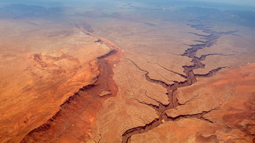
The Grand Canyon makes the list of the Seven Natural Wonders of the World, stretching 277 miles long through the United States' state of Arizona. You could fit the entire state of Rhode Island in the canyon's national park.
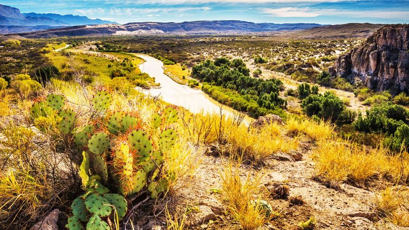
The Rio Grande runs through both the United States and Mexico, and forms part of the border between Texas and the country to our south. In Mexico, however, locals refer to it as Rio Bravo.
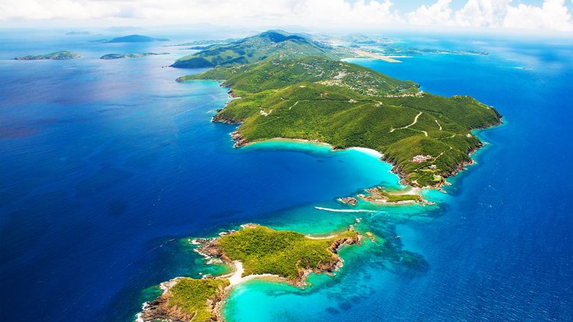
Spread over one million square miles, the area we know as the Caribbean boasts roughly 7,000 individual islands, from the smallest of the small like Saba to larger, more well-known islands like Cuba.
Advertisement
When you think of America's coastline, you probably forget our northernmost state – Alaska. Alaska has 6,640 miles of coastline that touch various bodies of water including the Pacific and Arctic oceans.
Nebraska has the distinction, among these choices, of being an area considered to be "triple landlocked." That means, if you lived there, you'd have to travel through at least three states in any direction to find the ocean.
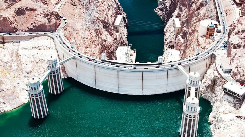
The Hoover Dam, situated at the border of Arizona and Nevada, was named for America's 31st president, Herbert Hoover. If you were comparing it in size to a skyscraper, it would jut approximately 60 stories into the air.
Advertisement
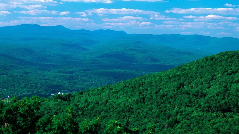
All 24,000 square miles of West Virginia are located in the Appalachian Mountain range, which stretches from Canada to Alabama. The state's legislature adopted the nickname officially in 1893.
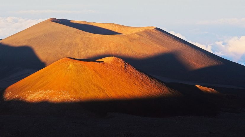
You probably thought the tallest mountain in the world was Mount Everest in Asia, but that's not correct. The tallest is actually Mauna Lea in Hawaii, which measures 32,000 feet when you start from the sea's floor.
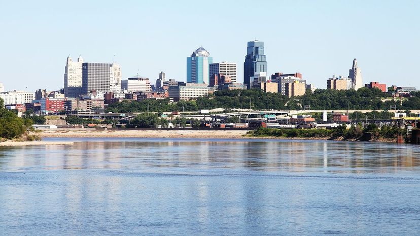
The Missouri River flows for roughly 2,300 miles, touching seven states from Montana to, you guessed it, Missouri. You may remember from your school days that the Missouri is the route Lewis and Clark used for their great expedition. Shown here is the Kansas City, Missouri, skyline along the banks of the Missouri River.
Advertisement

Thrill seeker? There are lots of amusement parks where you can experience a lengthy vertical drop, but none of them would compare to Mt. Thor, which is four times the height of the Eiffel Tower. Of course, this is no theme park ride, just nature.
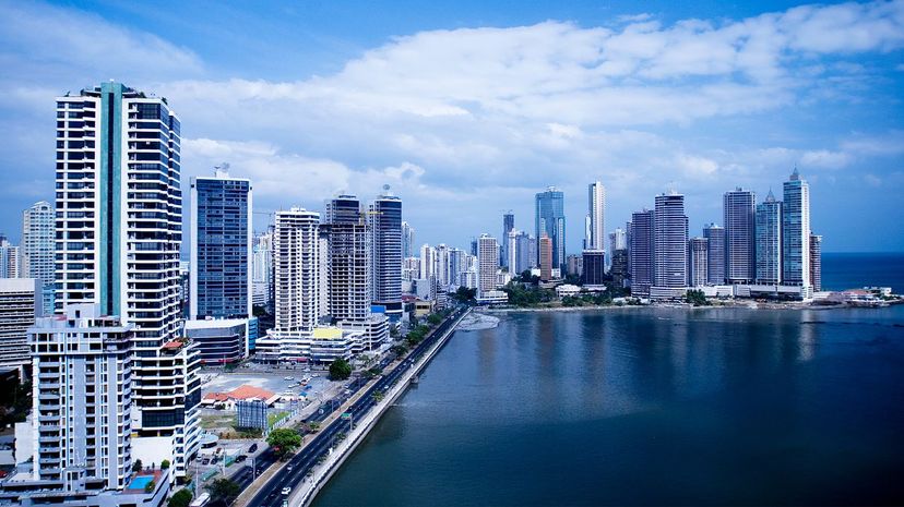
Central America might be the place to be if you're an ocean lover. No matter if you're in Panama City, shown here, or anywhere in the area, you're guaranteed to be no further from the ocean than roughly 125 miles. Umbrella drink not included.
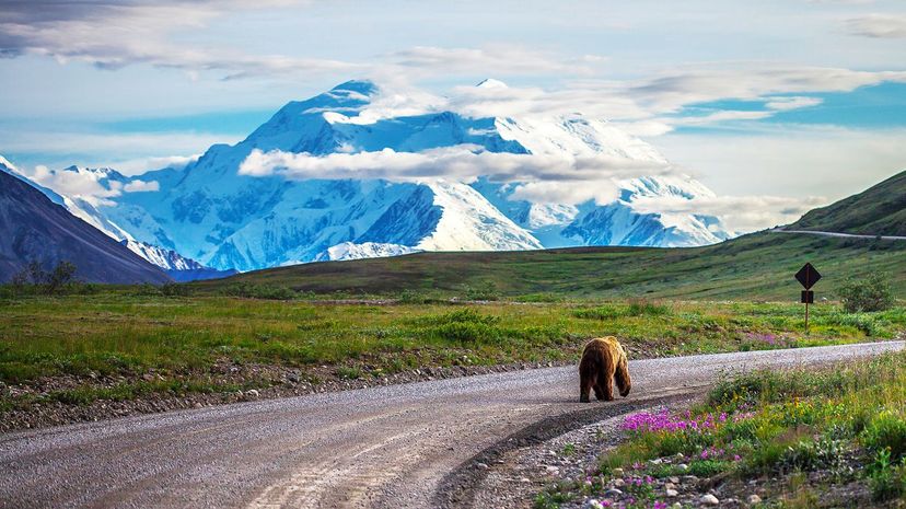
Denali, which was formerly known as Mt. McKinley, soars 20,310 feet in the air. The peak actually gained a few feet in 2015, when its height was recalculated from a 2013 measurement 73 feet shorter.
Advertisement
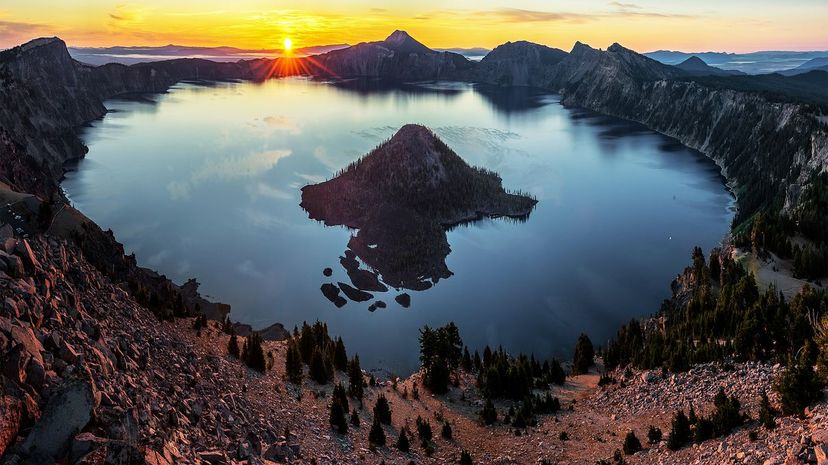
Crater Lake, appropriately named since it is the deepest cavity of water in the United States, is located in southern Oregon. It measures more than 1,900 feet deep at its deepest point.
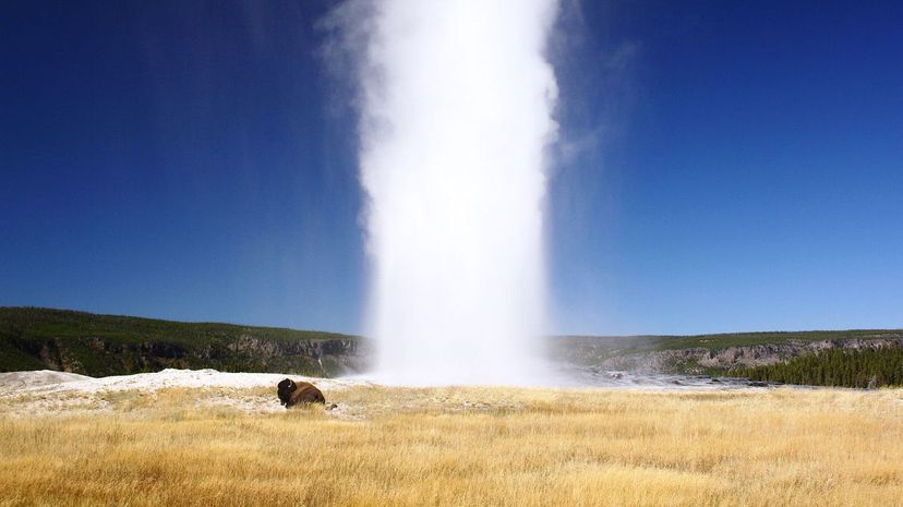
Yellowstone National Park's most well-known geyser, Old Faithful, erupts regularly--roughly every 90 or so minutes. A geyser is a type of hot spring where water erupts and bursts into the sky.
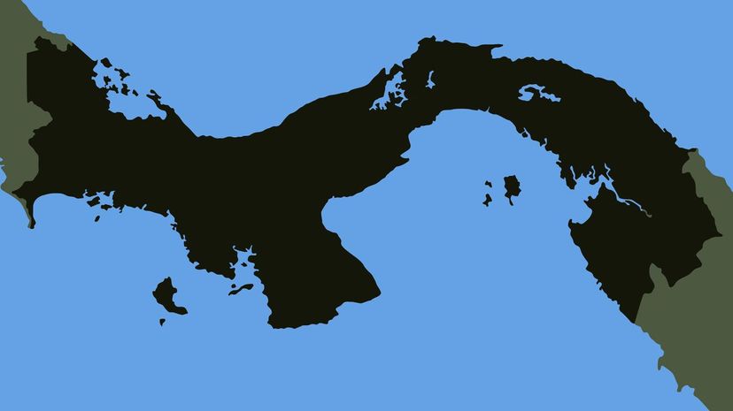
The most narrow point on the North American continent is in Panama, stretching just 31 miles across. At this point, this Caribbean Sea and Pacific Ocean are separated by roughly the same distance that exists between Los Angeles and Anaheim.
Advertisement
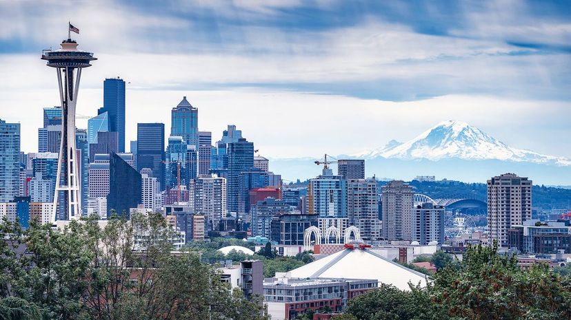
The Cascades begin in Canada's British Columbia province and run through Washington and Oregon before stopping in northern California. Mount Rainier in Washington, shown here, is the range's highest point.
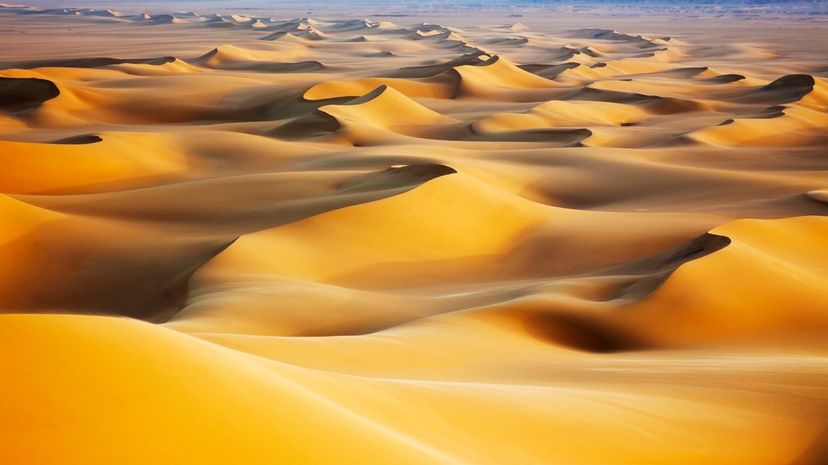
You can find the Sonoran, Chihuahuan and Mojave Deserts sprinkled throughout the United States' Southwest and into Mexico. The Sahara Desert, shown here, is located in Africa.
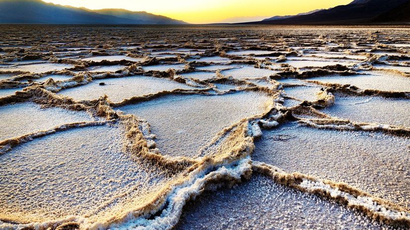
Death Valley is home to the lowest point in North America, a place called Badwater Basin. Death Valley is not only North America's lowest point, but also one of its driest. In 1929, it didn't rain for an entire year.
Advertisement
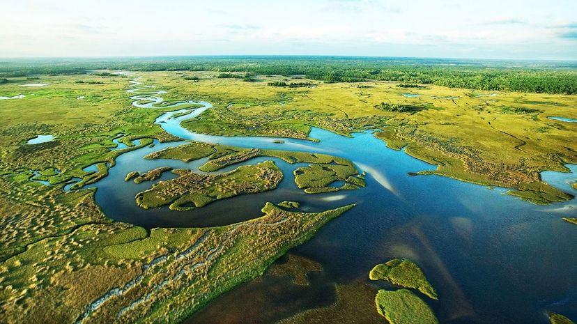
Everglades National Park, a wetlands system in southern Florida, is home to a diverse climate of mammals, birds and reptiles, including the endangered Florida panther and both alligators and crocodiles.
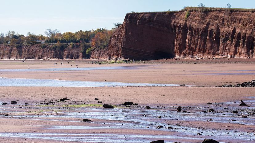
Visit Canada's Bay of Fundy, located between New Brunswick and Nova Scotia, if you want to see the world's highest tides--measuring up to 55 feet in height. The bay's spring tides are among its highest and occur two times a month year-round. Shown here, tourists explore the sea floor at low tide.
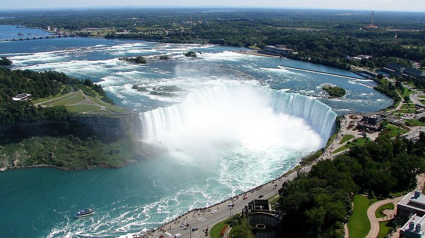
Niagara Falls can be observed from both the U.S. side and the Canadian side, shown here. Niagara Falls is actually a collection of three falls named American Falls, Bridal Veil Falls and Canadian Falls.
Advertisement
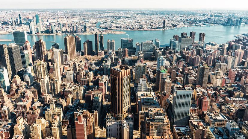
New York City is North America's largest urban area, with more than 24 million people. In fact, New York City is so large that roughly four dozen buildings boast their own ZIP codes.
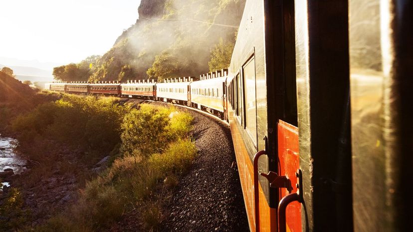
If you thought the Grand Canyon was impressive, Copper Canyon in Mexico may really knock your socks off. Copper Canyon encompasses 25,000 square miles, making it both larger and deeper than the Grand Canyon. The railway known as Chihuahua al Pacifico will give you a front-row seat to its breathtaking scenery.
The Gulf of Mexico, which is bordered by Mexico, the United States and Cuba, is an ocean basin where roughly three dozen major rivers empty. The largest of these is the Mississippi River.
Advertisement
The Catskill Mountains, in the northeastern United States, has 35 peaks at 3,500 feet or higher. If you make it to the top of each, you can become a card-carrying member of The 35 Club.
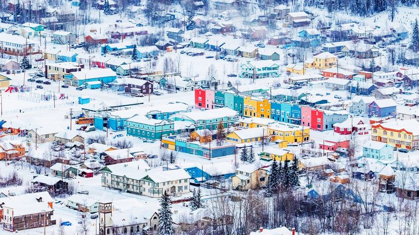
With a recorded temperature of -81.4 Fahrenheit, the Yukon Territory in Canada in North America's coldest location, officially. This temp was recorded in a village called Snag, so pack an extra coat if you're planning a visit. Shown here is Dawson City, Yukon Territory.
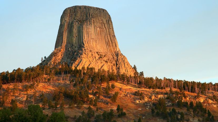
Devils Tower is located in Wyoming, a site designated as the United States' first national monument. Experts disagree on how the rock formation was formed, but most theories involve volcanic activity and magma or sedimentary rock. It features prominently in "Close Encounters of the Third Kind" by Steven Spielberg.
Advertisement
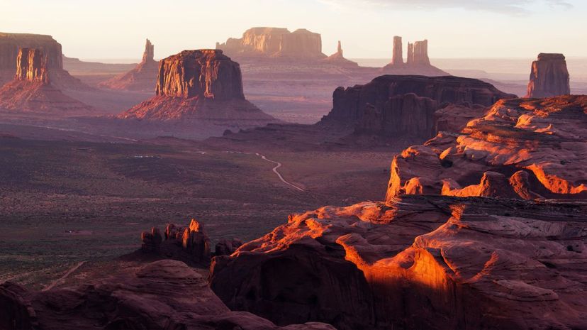
Monument Valley is a favorite of both novice photographers and professional filmmakers, a site noted for its tall sandstone buttes clustered throughout the valley. This gives the rock formations the appearance of extra-tall monuments.
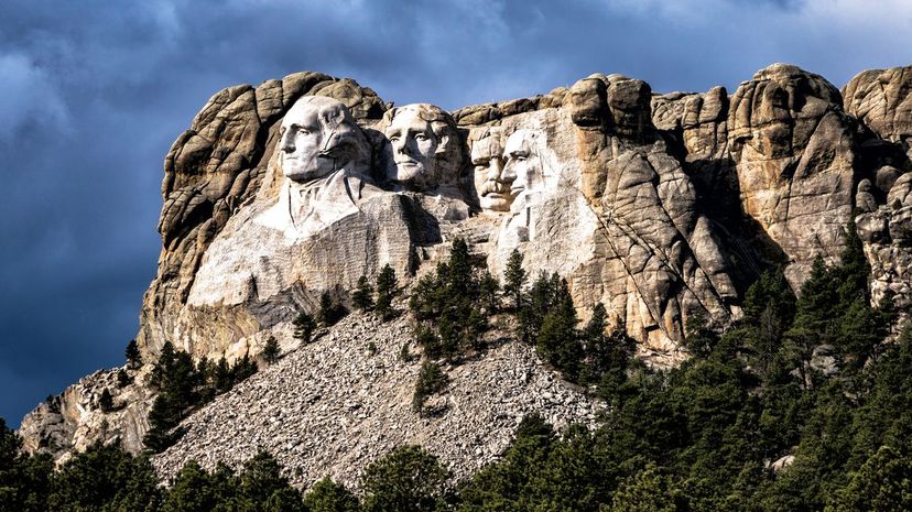
The Black Hills are a relatively small mountain range--just 110 miles in length--located in South Dakota and Wyoming. The Mount Rushmore monument is 60 feet high on a mountain that stands 5,725 feet high itself.
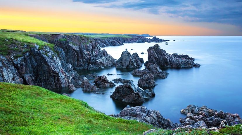
Newfoundland and Labrador, which most people just refer to as Newfoundland, has its own time zone. Newfoundland is 30 minutes ahead of the Atlantic time zone and a full 90 minutes ahead of Eastern time zone. Shown here is Dungeon Provincial Park in Newfoundland.
Advertisement
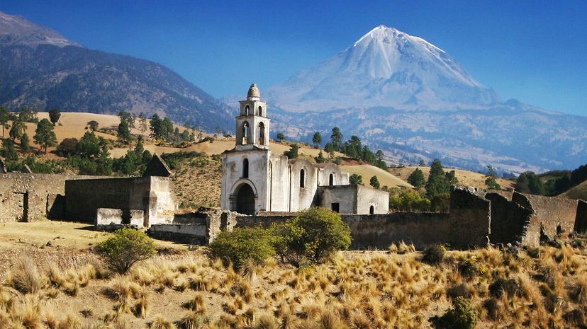
Coming in at 18,700 feet, Pico de Orizaba is North America's tallest volcano and Mexico's highest mountainous peak. Don't expect volcanic activity from this dormant formation anytime soon. The last activity from it was in 1846.