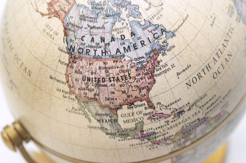
About This Quiz
When it comes to North America's magnitude, the numbers speak for themselves: it covers an area of 9,540,000 square miles and covers about 16.5 percent of the earth's terrain. The continent is home to Canada, the United States, Mexico, plus other countries in Central America and the Caribbean, so it should come as no surprise that the population surpasses 500 million people. With such immense size comes immense variety in landscape and climate, from the ice cold of Greenland to the tropical Caribbean.
The continent is mainly associated with the United States, but this quiz will be a real test for any self-proclaimed geography expert. Expect to find yourself considering all aspects of the continent from mountain ranges to lakes to the people. The natural beauty in North America draws tourists from all over the world but this quiz is going to make you question just how well you know these natural wonders.
After you get through all 30 questions, we guarantee that you'll be smarter than when you started and full of a newfound appreciation for the grandeur of North America. So go ahead and dive into this challenge.Â
The Rio Grande River separates the Texan and Mexican towns.
The population of North America is expected to reach more than 533 million in 2016.
This is true. Canada spans more than 3,855,100 square miles (9,984,670 square kilometers).
Advertisement
The Great Divide runs north and south through the Rocky Mountains.
The Great Plains features a broad expanse of prairie and steppe that lies east of the Rocky Mountains in both the United States and Canada.
Every country in North America borders an ocean. Canada, the United States, and Mexico border both the Atlantic and the Pacific.
Advertisement
The Rocky Mountain region has been mined for its copper, lead, gold, silver, tungsten, uranium and zinc.
The 50-mile (80-kilometer) Panama Canal, which was completed in 1914, is one of the most important waterways in the world - by connecting the Atlantic and Pacific oceans through the Isthmus of Panama, it dramatically shortens shipping routes.
Death Valley's Badwater Basin in Furnace Creek, California, has the lowest elevation in North America at 282 feet (86 meters) below sea level.
Advertisement
Canada, the United States and Mexico account for most of the North America land mass.
The Rocky Mountains are the largest chain in North America, stretching from British Columbia, Canada, to New Mexico.
Greenland's major physical feature is its massive ice sheet, which is second only to Antarctica's in size. The Greenland ice sheet covers more than 700,000 square miles (1.8 million square km) - more than 80 percent of its total land area.
Advertisement
The Everglades cover more than 4,300 square miles (11,137 square kilometers) of southern Florida.
Mexico City is identified as the most populous city in North America, with a population of nearly 20 million.
Lake Superior the largest freshwater lake in North America.
Advertisement
Both the Sierra Nevada and Cascades follow the Pacific Coast, shielding the humid winds that sweep in from the ocean.
It took more than 60 years from the time Maj. John Wesley Powell began to conduct geological studies of the Colorado River in 1869 until construction on the dam began in 1933. It only took five years to complete construction.
Denali, which is located within Denali National Park and Preserve in Alaska, stands at 20,320 feet (6,194 meters).
Advertisement
The Caribbean region includes more than 7,000 islands, islets, reefs and cays. Some have relatively flat and sandy terrain, while others are rugged, mountainous and volcanic.
Some of Earth's youngest mountains are in the Cascade Range of the U.S. states of Washington, Oregon and California, where some peaks began to form only about 1 million years ago.
The Great Lakes - Lake Superior, Lake Michigan, Lake Huron, Lake Erie and Lake Ontario - contain about 20 percent of the world's freshwater.
Advertisement
North America is divided into five physical regions: the mountainous West, the Great Plains, the Canadian Shield, the varied eastern region and the Caribbean.
While Kilauea in Hawaii is considered one of (if not the) most dangerous volcanoes in the U.S., it's actually Mauna Loa that is the largest.
The Missouri River is North America's longest river, beginning in western Montana and ending 2,341 miles (3,767 kilometers) away, north of St. Louis, Missouri, where it enters the Mississippi River.
Advertisement
The four major desert regions - Great Basin Desert, Sonoran Desert, Chihuahuan Desert and Mojave Desert - are all in the American Southwest and Northern Mexico.
There are a total of 23 countries in North America, including all of the Caribbean and Central American countries, Bermuda, Canada, Mexico, the United States and Greenland.
British Columbia borders four states: Washington, Idaho, Montana and Alaska.
Advertisement
North America borders four major bodies of water: the Pacific Ocean, Atlantic Ocean, Arctic Ocean and Gulf of Mexico.
North America is the third largest continent, after Asia and Africa.
Weather varies dramatically across the North American landscape. Climates range from arctic cold to equatorial heat and everything in between.
Advertisement